The research conducted in the field of Geoinformation uses Earth Observation and Geospatial Analysis to explore the interactions between humans and their environment. These studies typically operate within an interdisciplinary international framework, and aim to produce new geospatial information and interpretive keys to support development and informed decision-making. We use advanced techniques in remote sensing, geospatial analysis and spatial modelling techniques across a variety of applications, including the analysis of socio-spatial disparities in urban environments, estimating urban populations, monitoring urban growth, examining spatial aspects of public health, managing natural resources, and supporting humanitarian action.
We also organise a continuous training program in French in cartography, analysis, storage and management of geospatial data. The aim is to gain an in-depth understanding of how Geographic Information Systems (GIS) work, how to communicate effectively through well-designed maps, how to store and exploit data wisely, and how to combine data in analyses that enhance understanding of spatial phenomena. A short training course in the use of QGIS for cartography is also being organised. Furthermore, our teaching approach, rooted in an ethos of sharing knowledge to ensure equitable access, relies entirely on the use of free and open-source software. These widely adopted open-source tools play a crucial role in the democratization of GIS, actively contributing to the evolution of technical standards, particularly within the Open Geospatial Consortium. Our geographical scope extends from Belgium and Europe to low-income countries, particularly in sub-Saharan Africa.
-
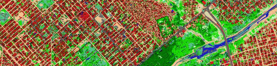
Land cover / Land use
-
Population
-
Urban inequalities
-
- ONEKANA - Earth Observation-based modelling for making thermal inequality visible in African cities
- PARTIMAP - Community Participation - combining Citizen Science and Earth Observation for mapping deprivation
- SLUMAP - Slum mapping and Characterisation in sub-Saharan African cities
- IDeAMapSudan - Capacity strenghtening for gender responsive and sustainable urban development: Integrated Deprivation Mapping System for Displacement Durable Solutions and socioeconomic reconstruction in Khartoum, Sudan
-
Hazard
-
Health